Science
Archaeologists Reveal Expanded Roman Road Network Across Continents

Archaeologists have uncovered a significantly larger network of Roman roads than previously understood, thanks to a recent digital atlas project. The study, named Itiner-e, reveals that the total length of Roman roadways spans nearly 300,000 kilometers (approximately 186,000 miles), marking an increase of over 100,000 kilometers since the last comprehensive atlas was published 25 years ago.
The discovery originated from an amateur metal detectorist’s find of Roman cavalry swords in Gloucestershire. This led researchers to explore a 2,000-year-old settlement, which included a villa and other building remnants, according to reports from Cotswold Archaeology and Historic England.
Innovative Techniques Unveil Ancient Pathways
The new atlas leverages modern technology, incorporating satellite tools and digital methods to map the ancient routes. Over five years, a dedicated team of archaeologists analyzed historical documents, ancient journals, and the locations of Roman milestones. They also utilized satellite imagery, including aerial photographs taken during World War II, to identify lost roads based on subtle signs in the terrain, such as variations in soil and vegetation, and remnants of ancient engineering.
Tom Brughmans, an archaeologist and co-author of the study published in Scientific Data, described the process as “a massive game of connecting the dots on a continental scale.” The atlas illustrates routes that connected over 5,000 ancient settlements, extending from Spain to Syria. Researchers previously estimated the extent of Roman roads at about 188,000 kilometers (approximately 117,000 miles), primarily focusing on major highways of the empire. The new findings highlight a vast network of secondary roads serving villas, farms, and military outposts.
Implications for Historical Understanding
While the study has greatly expanded knowledge of roads in regions such as North Africa and the interior plains of France, it also raises questions about the operational status of these pathways. Benjamin Ducke, a researcher from the German Archaeological Institute in Berlin, noted that it remains unclear if all identified roads were active simultaneously.
The name Itiner-e pays homage to ancient Roman itineraria, or travel registers that documented road stations and distances. By combining historical records with Geographic Information Systems (GIS), LiDAR technology, and crowdsourced archaeological data, the project has created a comprehensive resource for scholars and the public alike.
According to the study, only 2% to 3% of the mapped routes have been confirmed with “high certainty,” indicating clear physical traces. The remaining routes are considered probable, supported by various historical or environmental indicators. Brughmans emphasized that understanding these ancient routes could reshape perspectives on the movement of people during Roman times, including the rise of Christianity and the spread of ancient diseases.
The atlas provides an interactive map and dataset free for public access at itiner-e.org. This resource enables users to explore ancient routes, milestones, and settlements in detail.
Findings related to Ancient Rome continue to captivate both academics and the general public. In a separate discovery, archaeologists recently unearthed a large stone basin in Italy, dating back over 2,000 years, further highlighting the lasting impact of Roman civilization.
As researchers delve deeper into the ancient world, the insights gained from projects like Itiner-e may significantly influence future scholarship on imperial logistics, trade networks, and cultural exchanges across the vast Roman Empire.

Britain Deploys Military to Shield Belgium from Rogue Drones
Obsidian Plugin TagMany Transforms Note Organization Instantly

Trump Celebrates BBC Resignations Amid Controversy Over Editing

Victor Oladipo Joins Bucks’ G League Team, Aims for NBA Comeback

Celebrate Star of India’s 162nd Birthday with Free Dockside Access

Maryland’s Moore Advocates for Redistricting Amid Political Pressure

Archaeologists Reveal Expanded Roman Road Network Across Continents

Ritsu Dōan’s Late Goal Secures Eintracht Frankfurt Derby Win

Deadly Police Operation in Rio Targets Criminal Networks

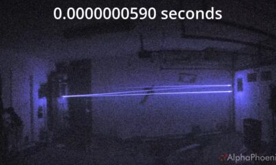
Inventor Achieves Breakthrough with 2 Billion FPS Laser Video

Community Unites for 7th Annual Into the Light Walk for Mental Health

Charlie Sheen’s New Romance: ‘Glowing’ with Younger Partner

Dua Lipa Aces GCSE Spanish, Sparks Super Bowl Buzz with Fans

Tyler Technologies Set to Reveal Q3 Earnings on October 22

Mother Fights to Reunite with Children After Kidnapping in New Drama

Curium Group, PeptiDream, and PDRadiopharma Launch Key Cancer Trial
R&B Icon D’Angelo Dies at 51, Leaving Lasting Legacy

Red Sox’s Bregman to Become Free Agent; Tigers Commit to Skubal
-
 Science3 weeks ago
Inventor Achieves Breakthrough with 2 Billion FPS Laser Video
-
 Health4 weeks ago
Community Unites for 7th Annual Into the Light Walk for Mental Health
-
 Top Stories4 weeks ago
Charlie Sheen’s New Romance: ‘Glowing’ with Younger Partner
-
 Entertainment4 weeks ago
Dua Lipa Aces GCSE Spanish, Sparks Super Bowl Buzz with Fans
-
 Business4 weeks ago
Tyler Technologies Set to Reveal Q3 Earnings on October 22
-
 Entertainment4 weeks ago
Mother Fights to Reunite with Children After Kidnapping in New Drama
-
 Health4 weeks ago
Curium Group, PeptiDream, and PDRadiopharma Launch Key Cancer Trial
-

 World4 weeks ago
R&B Icon D’Angelo Dies at 51, Leaving Lasting Legacy
-
 Entertainment4 weeks ago
Red Sox’s Bregman to Become Free Agent; Tigers Commit to Skubal
-
 Health4 weeks ago
North Carolina’s Biotech Boom: Billions in New Investments
-

 Top Stories3 weeks ago
Former Mozilla CMO Launches AI-Driven Cannabis Cocktail Brand Fast
-

 Science4 weeks ago
North Carolina’s Biotech Boom: Billions Invested in Manufacturing